Manali to Leh Bike Trip Guide: Route, Permits, Packing List & Itinerary
Quick Answer: Manali to Leh Highway (NH3)
The Manali to Leh Highway (NH3, 428 km) takes 2 to 3 days, crossing 5 high passes: Rohtang/Atal Tunnel, Baralacha La (4,890m), Nakee La, Lachung La, and Tanglang La (5,328m). Best Acclimatization Strategy: Sleep at Jispa (3,200m) on Night 1 rather than high-altitude Sarchu (4,290m) to prevent severe AMS. Non-LA-02 commercial rental bikes (HP plates) are allowed on NH3 for highway transit into Leh, but strictly barred from entering internal sightseeing circuits (Nubra/Pangong/Umling La) without switching to an LA-02 motorcycle in Leh.
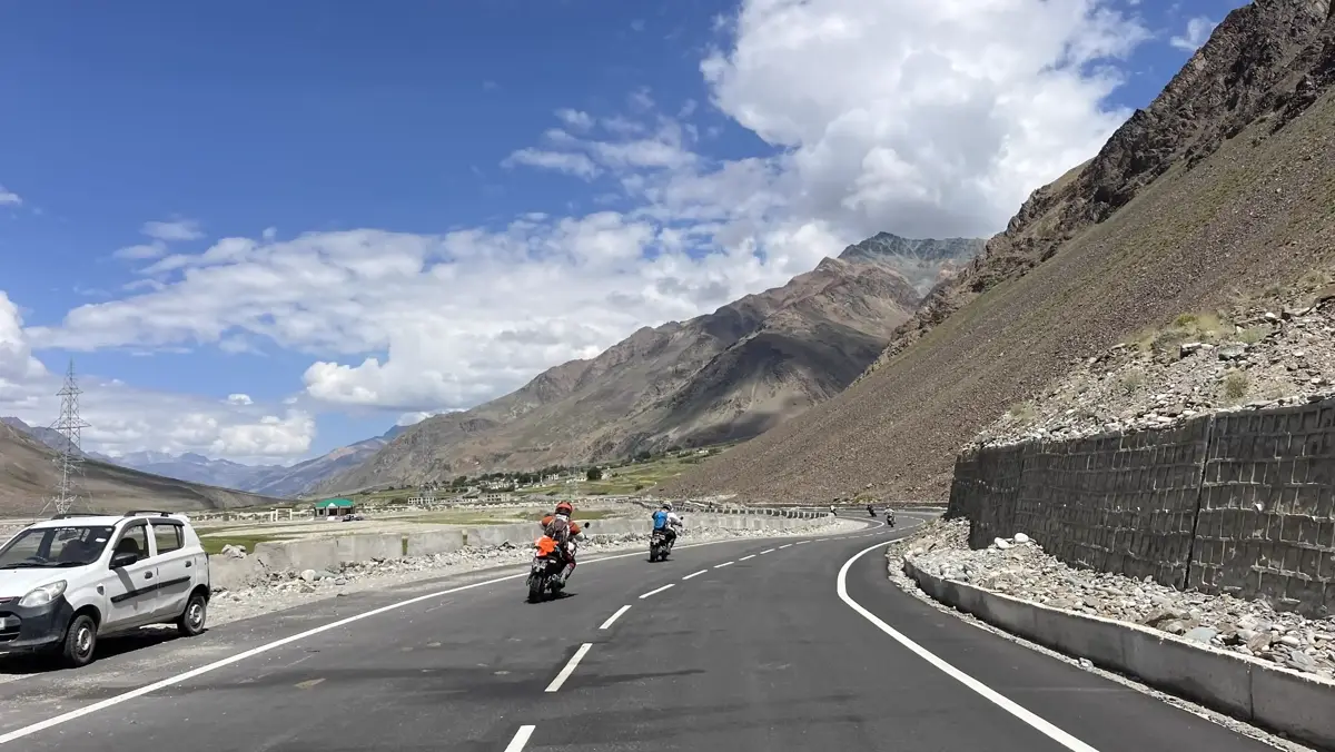
The Manali-Leh Highway (NH3) isn't just a road; it's a 428-kilometer-long rite of passage for adventure motorcyclists. Spanning across some of the most isolated terrains in the Indian Himalayas, it tests your machine, your physical endurance, and your mental grit. Having led over eighty motorcycle expeditions across this highway, I've seen riders make the mistake of treating this like a scenic weekend cruise. It is not. You will ride through water crossings fed by melting glaciers, climb five high-altitude passes, and sleep at elevations where the air contains 40% less oxygen than at sea level. This guide compiles everything we've learned over fifteen years of running Ladakh Bikers to help you survive and enjoy the legendary NH3.
1. The Route Breakdown: Distances, Passes, and Elevation Profile
Planning your daily mileage is critical on the Manali-Leh Highway. A common mistake is planning for 200 km a day; on this terrain, 100 km can easily take 6 to 8 hours depending on road washouts and water crossings.
- Manali to Keylong/Jispa (115 km - Elevation: 3,080m / 10,100 ft): Leaving Manali, you have two options. You can either take the scenic route over the classic Rohtang Pass (3,978m / 13,050 ft) or ride through the modern engineering marvel, the Atal Tunnel (9.02 km long, bypassing Rohtang). Taking the tunnel saves 3 to 4 hours and avoids the notorious Rohtang slush, but you miss out on the incredible views. Once you cross the tunnel or pass, you enter the rain-shadow valley of Lahaul, ending your day at Keylong or Jispa along the Bhaga River.
- Jispa to Sarchu (85 km - Elevation: 4,290m / 14,070 ft): This is where the real altitude begins. You will climb past Darcha checkpoint, head up to Patseo, and climb the majestic Baralacha La (4,890m / 16,040 ft). Near the top, you will see Suraj Tal, a stunning high-altitude lake. Descending Baralacha La brings you to Sarchu, the border between Himachal Pradesh and Ladakh. Warning: Sarchu is a barren wind-swept plateau at 14,070 feet. Sleeping here is notorious for causing headaches and sleeplessness (AMS) due to the sudden altitude gain.
- Sarchu to Leh (250 km - Elevation: 3,500m / 11,500 ft): A long, exhausting, but mind-blowing riding day. You start by climbing the Gata Loops—a series of 21 sharp hairpin bends spanning 10 km that climb from the riverbed. You will then cross Nakee La (4,739m / 15,547 ft) and Lachung La (5,065m / 16,616 ft) before descending into Pang, a temporary tent settlement. From Pang, the road opens up into the More Plains—a completely flat, high-altitude plateau stretching for 40 km at 15,000 feet. After More Plains, you climb the second-highest motorable pass in the world, Tanglang La (5,328m / 17,480 ft), before descending through Rumtse, Gya, and Upshi, joining the Indus River highway all the way into Leh.
2. Acclimatization and Altitude Sickness (AMS) Strategy
Acute Mountain Sickness (AMS) is your biggest enemy on this route. Because you are rising from Manali (2,050m) to Sarchu (4,290m) within 24 to 48 hours, your body does not have enough time to increase its red blood cell count to compensate for the thin air.
To mitigate this, we strongly recommend spending your first night at Keylong or Jispa rather than Sarchu. Jispa sits at 3,200 meters, which is a manageable step up from Manali. Only climb to Sarchu on Day 2. If you must stay at Sarchu, drink plenty of water (4 to 5 liters a day), avoid alcohol or heavy smoking, and keep a portable oxygen canister handy. If a rider shows symptoms of severe breathlessness or confusion, they must be descended to Keylong immediately.
3. Permits Required for NH3
You cannot simply start riding without paperwork. If you choose to ride over Rohtang Pass, you must secure a Rohtang Pass Permit from the Himachal Tourism website. The permit system is highly restricted to limit vehicular pollution. If you take the Atal Tunnel, you do not need the Rohtang permit, but you will need to pay a green tax at the Lahaul entry barrier. Upon entering Ladakh at the Upshi checkpoint, you must submit your Ladakh Inner Line Permits, which are required to visit restricted areas like Nubra and Pangong later in your trip.
4. Packing Checklist: Machine Spares and Self-Reliance
There are no mechanics or spare parts shops between Keylong and Karu (a stretch of almost 280 km). You must be completely self-reliant. Here is the bare minimum you should carry in your tool roll:
- Cables: Spare accelerator and clutch cables (pre-routed along the existing ones so you can swap them in 5 minutes).
- Spark Plugs & Fuses: At least two spare spark plugs and a set of electrical fuses.
- Tires: A puncture repair kit, tire irons, and a portable foot pump or 12V electric inflator that runs off your bike's battery. If your bike has spoke wheels (like the Himalayan 411), carry spare front (21-inch) and rear (17/18-inch) tubes.
- Lubricants: A can of chain lube (spray every 400-500 km, especially after water crossings) and a 1-liter bottle of engine oil for top-ups.
- Fuel: There are no petrol pumps between Tandi (near Keylong) and Karu (near Leh)—a distance of 340 km. You MUST carry at least 10 to 15 liters of extra fuel in Jerry cans or specialized fuel bladders.
5. Best Season to Ride
The Manali-Leh Highway is usually open from late May to mid-October. The absolute best window to ride is from June to early July, and then again from September to October. During late July and August, the monsoon hits the lower Himalayan region (Manali, Kullu, and the foothills), leading to heavy landslides and mud on the road before the Atal Tunnel. September offers the most stable weather, dry roads, and crisp blue skies, though the temperatures on the high passes can drop below freezing.
Safety Advisory
Road conditions in Ladakh fluctuate daily due to stream crossings, landslides, and weather. Always consult local checkpoint officers or message our Leh base camp for real-time conditions before leaving Leh.
Need a Reliable Ride?
Rent a specialized Royal Enfield Himalayan with full mounting gear from Leh Base Camp.
Browse Bike RentalsJoin A Guided Tour
Ride with expert guides, backup support trucks carrying oxygen cylinders, and mechanics.
View Guided ToursRelated Articles
- Manali to Leh vs Srinagar to Leh: Which Highway Should You Ride?July 20, 2026
- Srinagar to Leh Highway (NH1D): Route Map, Stops & Road ConditionsMay 18, 2026
- Best Time to Ride a Motorcycle in Ladakh: Month-by-Month Road & Weather GuideJune 10, 2026
- Ladakh Bike Trip Cost: Real Numbers and the Hidden ExtrasJuly 18, 2026