Pangong Lake to Leh Route Guide: Chang La Pass, Distance & Map
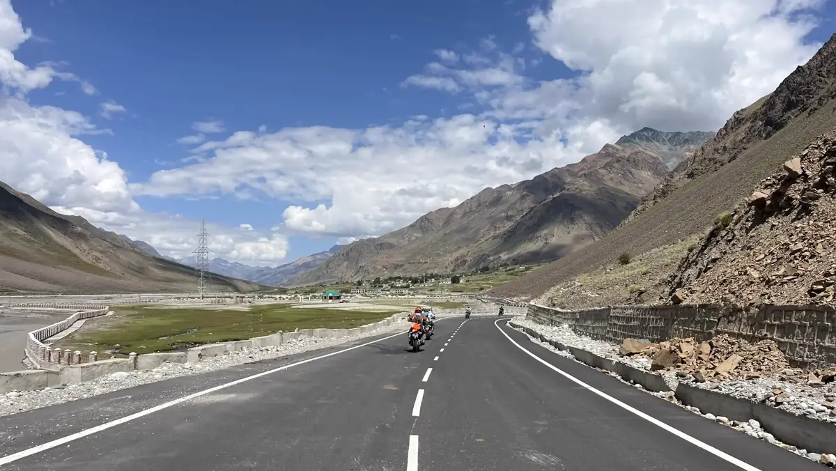
Quick Answer: Pangong Lake to Leh Motorcycle Route Guide
The Pangong Lake to Leh motorcycle route (160 km) takes approximately 5 to 6 hours of continuous riding, crossing Chang La Pass (5,360m / 17,585 ft) — officially recognized as the third highest motorable pass in the world. Key route milestones include Spangmik, Lukung, Tangtse army checkpoint, Zingral, Chang La summit, Sakti valley, Karu junction, and Thiksey Monastery on NH3. Fuel & Supplies: There are no commercial petrol pumps at Pangong Lake; the nearest fuel station is at Karu (125 km from Pangong). Ensure your stamped Inner Line Permit (ILP) copy is physically printed for the Tangtse military checkpoint inspection.
Riding from the brilliant turquoise shoreline of Pangong Tso (4,250m / 13,940 ft) back to Leh town is one of the most breathtaking motorcycle journeys in the Indian Himalayas. Spanning 160 kilometers, this high-altitude route cuts directly through the wild Changthang plateau, climbs over the snow-frosted summit of Chang La pass, and descends into the fertile Indus Valley. Having guided over a hundred groups along this specific corridor for Ladakh Bikers, I've compiled this exhaustive, step-by-step handbook to help you navigate road surfaces, pass safety, checkpoint requirements, and mechanical planning. If you'd rather ride it guided, see our Pangong Lake Tour package for pricing and departure dates.
1. Complete Route Breakdown: Distances, Elevation & Riding Timeline
Do not let the seemingly short 160 km distance fool you. Altitude gain, narrow mountain switchbacks, military truck convoys, and unpaved pass sections mean your average riding speed will be between 25 and 35 km/h.
- Pangong Lake (Spangmik / Man) to Tangtse (35 km — Elevation: 4,350m to 3,950m): Leaving the lake shore at Spangmik, you ride west along flat gravel and asphalt tracks. The road follows a wide river basin past Lukung village to Tangtse, the major administrative hub for the region. Here you will find small tea dhabas, local homestays, and the mandatory army checkpoint.
- Tangtse to Zingral (25 km — Elevation: 3,950m to 4,350m): The road gradually ascends through barren rocky gorges. Zingral is a small military outpost located at the foot of Chang La. This is where the steep mountain climb begins.
- Zingral to Chang La Summit (20 km — Elevation: 4,350m to 5,360m / 17,585 ft): A dramatic, continuous climb featuring sharp hairpin curves and steep gradients. You gain over 1,000 meters of elevation in just 20 km. The road surface transitions from tarmac to broken blacktop, loose shale, and wet meltwater slush near the summit.
- Chang La Summit to Sakti & Chemrey (35 km — Elevation: 5,360m to 3,400m): Descending the west face of Chang La brings you into the Sakti Valley. The descent is steep with tight hairpins, but the road quickly improves into smooth asphalt curves passing the picturesque Chemrey Monastery perched on a hill.
- Sakti / Karu to Leh City (45 km — Elevation: 3,400m to 3,500m): At Karu, you join the 4-lane Manali-Leh Highway (NH3) running along the Indus River. This stretch is fast, smooth tarmac passing Stakna, Thiksey, and Shey palaces into Leh.
2. Navigating Chang La Pass (5,360m / 17,585 ft): Road Conditions & Safety
Chang La is often considered more challenging than Khardung La because of its steeper approach gradient and unpaved summit stretches. Here is how to conquer it safely on two wheels:
- Meltwater Streams (Pagla Nallahs): On sunny afternoons, snowfields above Chang La melt rapidly, sending cold torrents of water across the road between Zingral and the summit. Cross early in the morning (before 11:00 AM) when stream volume is low. Keep your bike in 1st or 2nd gear, maintain steady revs, and stand slightly on your footpegs for balance.
- Summit Protocol: At 17,585 ft, the atmospheric oxygen content is 45% lower than sea level. Limit your summit stop to 15 to 20 minutes maximum. Grab a cup of hot tea at the army tea stall, take your photo at the iconic Chang La Baba shrine, and begin your descent immediately to prevent altitude-induced headaches.
- Braking Technique on Descent: On the steep descent toward Sakti, avoid riding your rear brake continuously, which can overheat brake fluid and cause pedal fade. Use engine braking in lower gears and apply progressive front and rear brake pulses.
3. Military Checkpoints & Inner Line Permit Requirements
Because Pangong Lake shares border territories with China (Line of Actual Control), military security is strictly enforced along this corridor.
You will encounter the primary checkpoint at Tangtse. All riders must submit a physical, hard-copy paper printout of their stamped Inner Line Permit (ILP) for domestic tourists, or Protected Area Permit (PAP) for foreign nationals. Digital permits shown on mobile screens are strictly rejected. Carry at least 4 physical permit copies in your jacket's chest pocket for fast processing.
4. Critical Fuel Strategy & Refueling Points
There are zero commercial petrol pumps between Leh and Pangong Tso along the main Chang La route. The total round-trip distance is approximately 320 km.
Most Royal Enfields carry a 13–17-liter fuel tank (13L on the Classic 350, 15L on the Himalayan 411, 17L on the Himalayan 450), so you must either carry a 5-liter jerry can of spare fuel or top up at Karu petrol pump on your way out of Leh. In emergencies, black-market fuel in plastic bottles can be purchased at local shops in Tangtse or Spangmik at premium prices (₹130–₹160 per liter), but always filter it through a mesh cloth to remove sediment.
5. Machine Prep & Spare Parts Checklist
Before starting your ride back from Pangong, perform a 5-minute morning pre-ride inspection on your bike:
- Drive Chain Slack & Lube: Dust and water crossings strip chain lubrication quickly. Spray chain lube and check slack (25–30mm).
- Tire Pressure: Set cold tire pressures (25 PSI front, 30–32 PSI rear for Himalayan). Remember that cold mountain air drops pressure by 2–3 PSI.
- Essential Tools: Carry spare clutch/accelerator cables, spark plug, puncture kit, foot pump, and 1 liter of 15W-50 engine oil.
6. Cultural & Sightseeing Highlights Along the Route
Make time to visit these historic landmarks on your ride into Leh:
- Chemrey Monastery: A 17th-century Buddhist monastery of the Drugpa Kagyu order built on a steep hill in Sakti.
- Thiksey Monastery: Located 19 km from Leh, this 12-story complex resembles the Potala Palace in Lhasa and houses a magnificent 49-foot statue of Maitreya Buddha.
- Shey Palace: The ancient summer capital of the Kings of Ladakh, featuring a giant copper-gilded Buddha statue.
Planning a ride to Pangong Lake? View our Guided Pangong Tour Packages or Rent an LA-02 Royal Enfield in Leh.
Safety Advisory
Road conditions in Ladakh fluctuate daily due to stream crossings, landslides, and weather. Always consult local checkpoint officers or message our Leh base camp for real-time conditions before leaving Leh.
Need a Reliable Ride?
Rent a specialized Royal Enfield Himalayan with full mounting gear from Leh Base Camp.
Browse Bike RentalsJoin A Guided Tour
Ride with expert guides, backup support trucks carrying oxygen cylinders, and mechanics.
View Guided ToursRelated Articles
- Pangong Lake Loop via Shyok River: The Complete Rider's AdvisoryMay 22, 2026
- Tso Moriri vs Pangong: Which Lake Is Worth Your Extra DayJune 18, 2026
- Nubra Valley vs Pangong Tso: Which Should You Prioritize on a Short Trip?August 10, 2026
- Leh to Nubra Valley Guide: Khardung La, Distance & MapJune 22, 2026